Scientists discover massive mountains under Earth’s crust

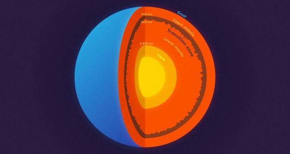
Scientists have discovered massive mountains in the Earth’s mantle, an advance that may change our understanding of how the planet was formed. Most school children learn that the Earth has three layers: a crust, mantle and core, which is subdivided into an inner and outer core.
While that is not wrong, it does leave out several other layers that scientists have identified within the Earth.
In a study published in the journal Science, scientists used data from an enormous earthquake in Bolivia to find mountains and other topography on a layer located 660 km straight down, which separates the upper and lower mantle.
Lacking a formal name for this layer, the researchers simply call it “the 660-km boundary.”
To peer deep into the Earth, scientists from the Princeton University in the U.S. and the Institute of Geodesy and Geophysics in China, used the most powerful waves on the planet, which are generated by massive earthquakes.
Data from earthquakes that are magnitude 7.0 or higher send out shockwaves in all directions that can travel through the core to the other side of the planet — and back again.
For this study, the key data came from waves picked up after a magnitude 8.2 earthquake — the second-largest deep earthquake ever recorded — that shook Bolivia in 1994.
Scientists used powerful computers to simulate the complicated behaviour of scattering waves in the deep Earth.
The technology depends on a fundamental property of waves: their ability to bend and bounce.
Just as light waves can bounce (reflect) off a mirror or bend (refract) when passing through a prism, earthquake waves travel straight through homogenous rocks but reflect or refract when they encounter any boundary or roughness.
“We know that almost all objects have surface roughness and therefore scatter light,” said Wenbo Wu, who was at Princeton at the time of the study.
“That’s why we can see these objects -- the scattering waves carry the information about the surface’s roughness,” said Wu, who is now a postdoctoral researcher at the California Institute of Technology in the US.
“In this study, we investigated scattered seismic waves traveling inside the Earth to constrain the roughness of the Earth’s 660-km boundary,” Wu said.
The researchers were surprised by just how rough that boundary is — rougher than the surface layer that we all live on.
“In other words, stronger topography than the Rocky Mountains or the Appalachians is present at the 660-km boundary,” said Wu.
Their statistical model did not allow for precise height determinations, but there’s a chance that these mountains are bigger than anything on the surface of the Earth.
The roughness was not equally distributed, either; just as the crust’s surface has smooth ocean floors and massive mountains, the 660-km boundary has rough areas and smooth patches.
The researchers also examined a layer 410 km down, at the top of the mid-mantle “transition zone,” and they did not find similar roughness. The presence of roughness on the 660-km boundary has significant implications for understanding how our planet formed and evolved.
Courtesy : The Hindu
