Advisory for deep depression over Southeast Bay of Bengal
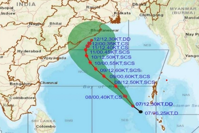
The Department of Meteorology says the depression over southeast Bay of Bengal has turned into a deep depression and lay centered at 1730hrs on Saturday (May 07) near 10.2N and 90.5E.
It is very likely to move north-westwards and intensify into a cyclonic storm over southeast Bay of Bengal over the next few hours and further into a severe cyclonic storm over East-central Bay of Bengal by 1730hrs on Sunday (May 08).
There can be very heavy showers or thundershowers, strong winds 70-80 kmph gusting up to 90 kmph associated with high seas over the aforementioned sea areas.
Wind speed can increase up to 70- 80 kmph in sea areas between (Equator - 04 N) and between (80E – 95E).
Naval and fishing communities are advised not to venture into the sea area bounded by (07N-16N and 85E-95E) and the sea areas bounded by (00-04N, 80E-95E) until further notice.
They are requested to be attentive to future forecasts issued by the Department of Meteorology in this regard.
Those who are out at aforementioned sea regions are advised to return to coasts or move to safer areas immediately.
Land areas:
Showers or thundershowers will occur at several places in Western and Sabaragamuwa provinces and in Galle and Matara districts during the evening or night.
A few showers may occur in the Western, Eastern and Southern coastal areas during the morning too.
Winds speed can increase up to 40 kmph at times in the Northern, North-central, North-western provinces and in Hambantota district.
The general public is advised to take adequate precautions to minimize damages caused by temporary localized strong winds and lightning during thundershowers.